
A Beginners Guide to Navigating Our Snowmobile Trails
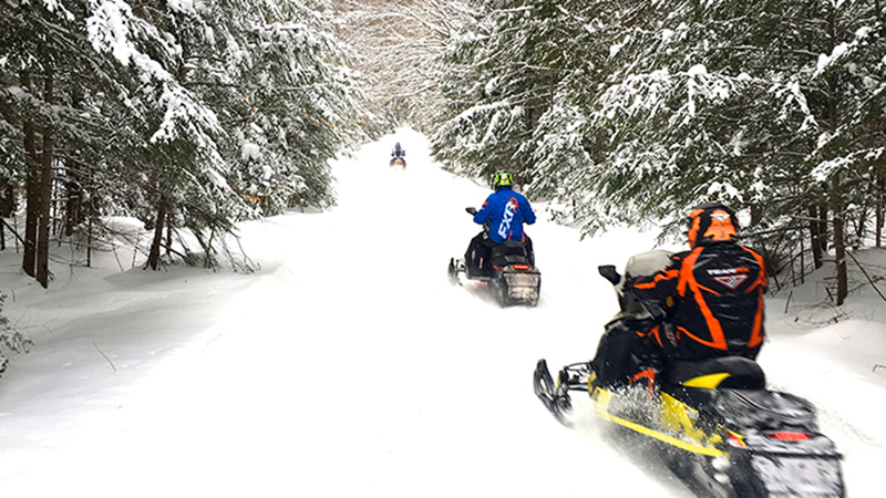
So what’s your outdoor activity going to be this winter? A 2019 study by the University of Guelph confirmed that snowmobiling is good for your physical well-being and mental health. Fortunately, as I wrote in the November/December issue of this magazine (“Discover OFSC Snowmobile Trails This Winter”), our Kawarthas/Haliburton area offers some of Ontario’s best snowmobiling, right from your doorstep. So now’s your time to get started and stay healthy!
 Our Winter Playground
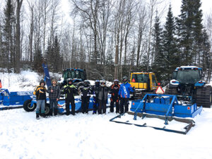
The Kawarthas/Haliburton area comprises recreational snowmobile trails managed by local clubs belonging to the Ontario Federation of Snowmobile Clubs (OFSC). These include the largest club in the province, Haliburton County Snowmobile Association (HCSA), celebrating its 50th anniversary this year, and recently named the 2021 OFSC Club of The Year.
The core of our region’s trail system is located within a giant rectangle located between the north shores of the Kawartha Lakes and the southern boundary of Algonquin Park. It’s anchored in the southwest by Fenelon Falls, northwest by Haliburton, northeast by Bancroft and southeast by Havelock.
Within this framework, over 2,000 kilometres of premier OFSC trails criss-cross the Kawartha/Haliburton hinterlands. Mostly land-based, these corridors include OFSC routes designated as Trans Ontario Provincial (TOP) Trails and many Club Trails. All are displayed on the OFSC Interactive Trail Guide (ITG), on the Go Snowmobiling PRO App (works even without cell service), and also on the printed trail guides from OFSC Districts 2 (Central Eastern Area Snowmobile Region) & the HCSA.
Certainly at first glance, so many trails may appear confusing to beginners. But not if you understand how everything’s organized. Here’s what you need to know about winter wayfinding…
Understanding Trail Types
For trail navigation, it’s important to understand the aforementioned trail types. There are two kinds of TOP Trails in our Kawartha/Haliburton area. First, Trunk Trails are the main corridors that run through and link multiple Ontario regions; they are identified by a reddish colour and a single letter on trail maps and signs. For example, TOP E crosses the northern part of Kawarthas/Haliburton, near Bancroft and Haliburton. Next, Feeder Trails provide access from snowmobile-friendly communities to a Trunk Trail and are shown in blue with a letter-number combination (e.g. TOP E108), where the letter indicates the Trunk Trail to which the Feeder leads.
These are the primary type of TOP Trails found in our Kawarthas/Haliburton area, although a third type, Connector Trails (coloured dark green and with a letter-number-letter combo – TOP B106E ) are present elsewhere, but not in our immediate riding area. Finally, Club Trails are local routes, coloured orange and shown by numbers only. All OFSC trails are groomed and signed to the same provincial standard, regardless of what type they are.
 Using The Interactive Trail Guide
The best way to plan your Kawarthas/Haliburton ride is using the ITG. When you open the map face, the default setting is “Trail Status” (see checked blue box in the Legend at lower left.) Trail Status view provides the most up to date information about whether or not a specific trail or part thereof is available to ride at the time you actually want to go. Trail Status shows all trails as Green (available to ride), Yellow (limited availability) or Red (unavailable). Red is a flag that means to avoid riding that trail at that specific time because for some reason it is not safe or legal to do so. Red means stay off that trail until the colour changes to Yellow or Green.
When you deselect the Trail Status check box, the view changes to “Trail Network”, where all of the trail types and their locations appear with their various names and colours. The Trail Network view is the best tool for planning your ride in advance (check out the “Plan Your Trip” tool in the upper left corner).
Trail Network enables you to choose where you’d like to go for any given ride and to calculate the distance. You can also display many amenities and services by selecting their icons in the Legend. The easiest way to see the Kawarthas/Haliburton trails close up is to go to the “Districts” box in the upper right corner and select District 2, which zooms the map face to view our trails.
If you click on the “Snow Tours” in the upper right corner and select “Central Ontario East-Kawarthas” from the drop down menu, you can also highlight the 128-kilometre Kawartha Highlands Tour, the 105-kilometre Trailblazer Trail Loop or the 75-kilometre Forest & Rail (FAR) Loop on the map face. All are ideal family day rides. No matter what ride you plan, be sure to revisit Trail Status View before you leave home to reconfirm that all trails are still available.
Now you know the basics of navigating OFSC trails throughout Kawarthas/Haliburton. So, besides a reliable sled, all you need is to comply with provincial law by purchasing a 2022 Ontario Snowmobile Trail Permit (available at OFSC website) and carry proof of sled registration and insurance. Then, you’re good to go – after all, trail riding is good for your health!
Learn More About OFSC Trail Riding At:
Ontario Federation of Snowmobile Clubs – www.ofsc.on.ca
Intrepid Snowmobiler – www.intrepidsnowmobiler.com
OFSC District 2 – www.district2ofsc.ca
Haliburton County Snowmobile Association – www.hcsa.ca
Story & Photos by Craig Nicholson, The Intrepid Snowmobiler